
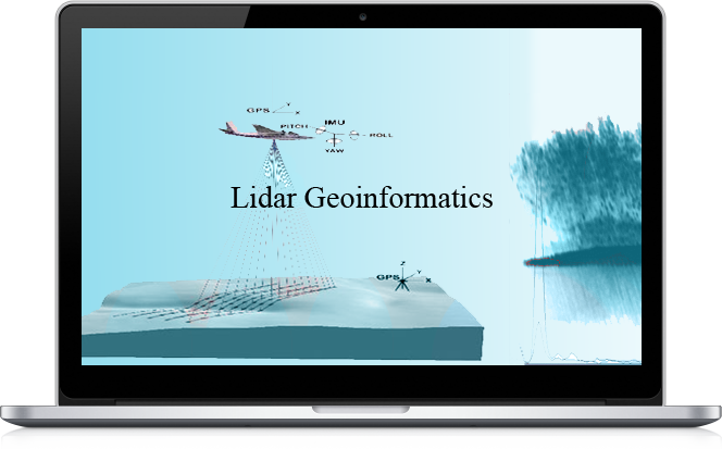
GIS Lidar Geoinformatics
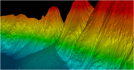
LiDAR technology offers one of the most accurate, expedient and cost-effective ways to capture elevation information. LiDAR data is directly processed to produce detailed bare earth models in a variety of formats including LAS, ASCII, ESRI and CAD. Derived products include DEM, DTM, DSM, slope/aspect, topographic maps and planimetric detail.
Pycas Design innovations utilizes state of the art technology. This ultra high point density corridor and wide-area LiDAR system used by Pycas is capable of achieving measurement rates of 500 kHz, and unsurpassed control over the scan pattern on the ground. We are staffed by some of the most seasoned LiDAR professionals in the industry. These specialists have extensive experience with all facets of LiDAR including applications development, sensor development,survey, programming, data processing, data acquisition, GPS and IMU process development and multi-sensor integration.
LiDAR Applications
- Coastal erosion analysis
- Forestry applications
- Geo-reference location structures
- Large-scale civil engineering projects
- Landslide risk mapping
- Defense applications
- Open pit mining
- Pipelines construction
- Open pit mining operations where the final data is needed within a few hours of collection
- Coastal erosion analysis, Flood risk mapping & Forestry applications
- Coastline and dune surface profiles with lesser relief.
- Wetland areas where no ground point can be installed due to restricted access.
- Forest areas where vegetation cover prevents visibility of the ground in aerial photographs.
- Open pit mining operations where the final data is needed within a few hours of collection.