
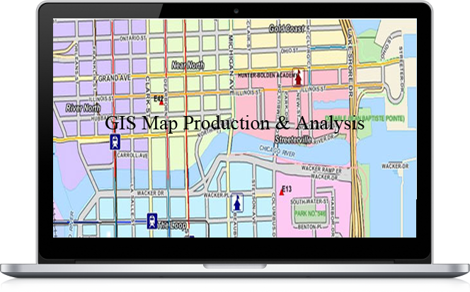
Serving all of your GIS and mapping needs
Our GIS Services assist our customers in producing base maps including its data model. This helps to create, landscape maps, environmental maps for industries such as mining, utility sector, agriculture, petroleum pipelines and for town planning, Our complex GIS Mapping Services includes capturing, storing, integrating, manipulating, analyzing, and displaying data related to positions on the Earth’s surface. Pycas Design is committed in maintaining state-of-the-industry technology, research and innovation, implemented by highly experienced and qualified staff. We prepare maps using Geographic Information Systems (GIS) technology, based on data provided by our clients. We help our clients to store, retrieve, manage, display, and analyze all types of geographical and spatial data and produce cartographic products. GIS map analysis allows us to view, understand, question, interpret, and visualize data in many ways that reveal relationships, patterns, and trends in the form of maps, globes, reports, and chart. The information outputted can be integrated into any enterprise information system frameworkOur Services
- Civil Structures suitability (Alignment and designing civil amenities)
- Infrastructure and Town/City planning
- Natural disaster management and recovery plan (Risk assessment)
- Maps digitization and GIS conversion
- 3D Modeling and DTM, DEM to understand aspect of land
- e-governance and application development using MapObjects and VB
- Industrial site location (Zoning Atlas), Environment Impact Assessment
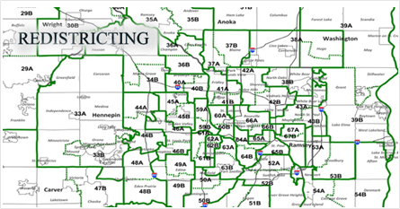
- Redistricting, Municipal applications, Census, Business Geographic's
- Crime analysis and Police patrolling
- Pre-feasibility study for construction of road network
- Total Station Survey (city mapping) and GIS generation towards OFC O & M for cellular service provider.
- Alignment, routing and lay outing of power supply cables i.e. topography surveying, and Geo-Technical Investigation etc.,
- GPS surveying for locating the Electric Utilities and Transformers & Topographic Survey
- Application development using VB and Map Objects
- Industrial Estate Planning/ Layout Planning and GPS & DGPS Survey
- Designing and alignment of Canal
- Wasteland mapping
- Rural telephony planning for establishment